On this page:
About the parkland
The bunjil nganga Parkland (Quarry Hills) will expand to create approximately 1,100 hectares of green open space for communities in and around Mernda, Wollert, Epping and South Morang. The new, larger parkland will also help protect native plants and animals and strengthen cultural heritage.
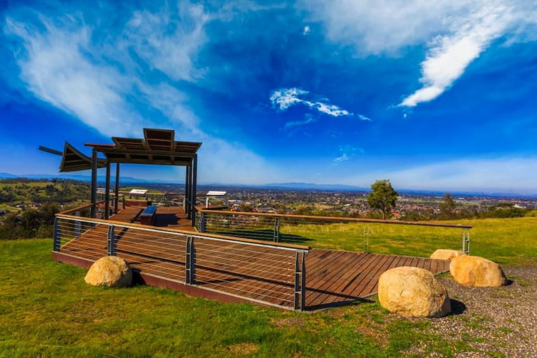
In the parkland, visitors can experience new walking and cycling trails. Visitors can also connect with nature and enjoy healthy outdoor activities.
The City of Whittlesea manages bunjil nganga Parkland (Quarry Hills) in partnership with the Wurundjeri Woi-wurrung Cultural Heritage Aboriginal Corporation.
Where is the parkland located?
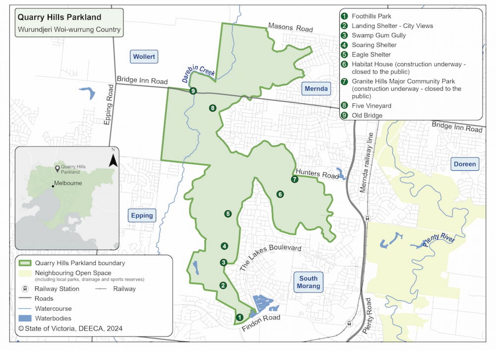
The parkland stretches from Mernda to South Morang, around 30 kilometres north-east of Melbourne’s CBD. It is on the lands of the Wurundjeri Woi-wurrung People.
bunjil nganga Parkland (Quarry Hills) map
When will the park open?
bunjil nganga Parkland (Quarry Hills) is open for visitors to enjoy now. Information is available on the CIty of Whittlesea website.
More information
For more information, you can view resources below:
Watch the Quarry Hills Regional Parkland video on YouTube.
To find out more, contact the Suburban Parks Program team.
Page last updated: 12/08/25