Expanding and protecting parkland for communities in Melbourne’s north-west.
On this page:
About the parklands
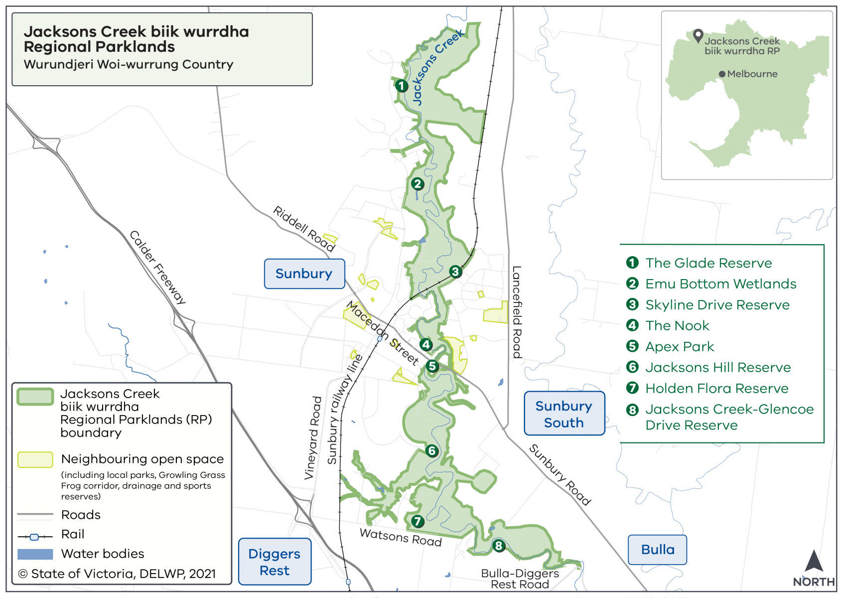
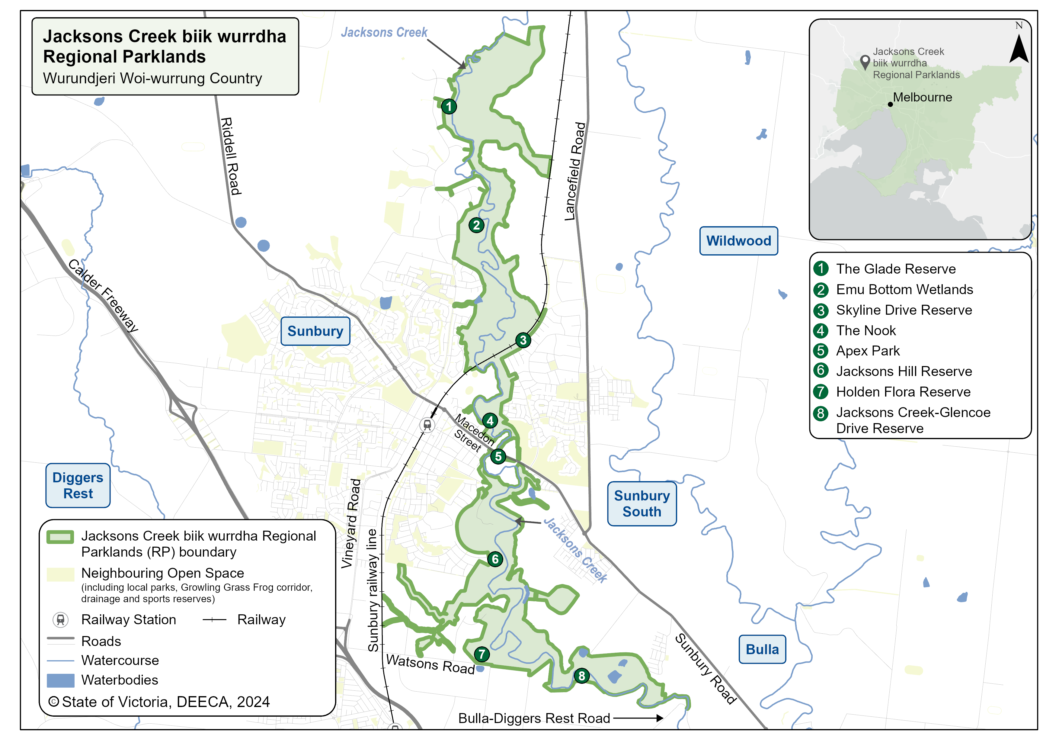
Jacksons Creek biik wurrdha Regional Parklands will span over 1,000 hectares and stretch along Jacksons Creek from Sunbury to Diggers Rest.
The name ‘biik wurrdha’ means ‘land of many’ and is the name given to Jacksons Creek by the Traditional Owners of the land, the Wurundjeri Woi-wurrung.
Watch the biik wurrdha video
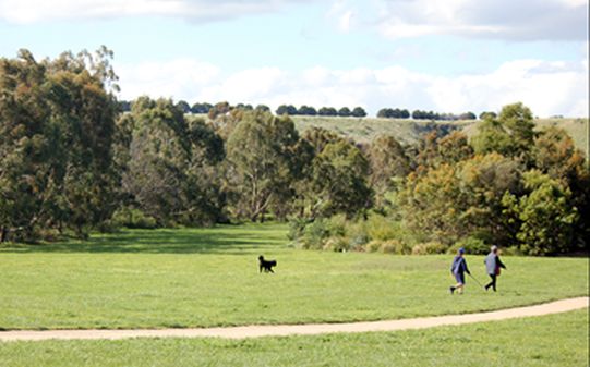
The parklands will create green open spaces for visitors to enjoy, and protect plants and animals. DEECA is working with parkland partners to realise the vision in the Jacksons Creek biik wurrdha Parklands Plan 2022.
The Victorian Government is investing in a shared walking and cycling path and signage to enhance visitor connections to nature. An archaeological survey is also being undertaken to inform future infrastructure development, whilst protecting cultural and biodiversity values.
Where are the parklands located?
The Jacksons Creek biik wurrdha Regional Parklands extend from Diggers Rest to Sunbury in Melbourne’s north-west, on the lands of the Wurundjeri Woi-wurrung People.
Some areas of the parklands aren't open to the public to protect high conservation and cultural values.
Jacksons Creek biik wurrdha Regional Parklands Map
Visitors can enjoy the Jacksons Creek biik wurrdha Regional Parklands now.
Enjoy these parkland areas
Visit The Nook to enjoy a picnic under the shady trees while watching birdlife and enjoying the creek edge. Toilet facilities and car parking are available.
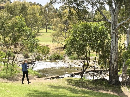
Visit Emu Bottom Wetlands to see the new habitat restoration works, or maybe even see a platypus.
Watch the video to learn about the flora and fauna at Emu Bottom Wetlands. The Emu Bottom Master Plan sets out the vision and principles for ongoing care of the space. Read more online here.
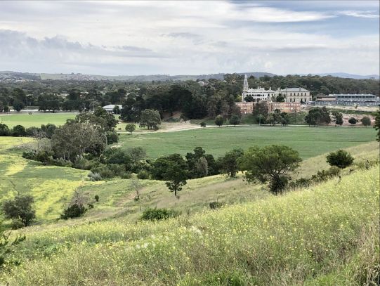
Visit Jacksons Hill Reserve and enjoy the all-abilities path down the valley. View the historic mill while listening to the creek flow. At sunset, enjoy the colours of the red cliffs on the other side of the creek.
