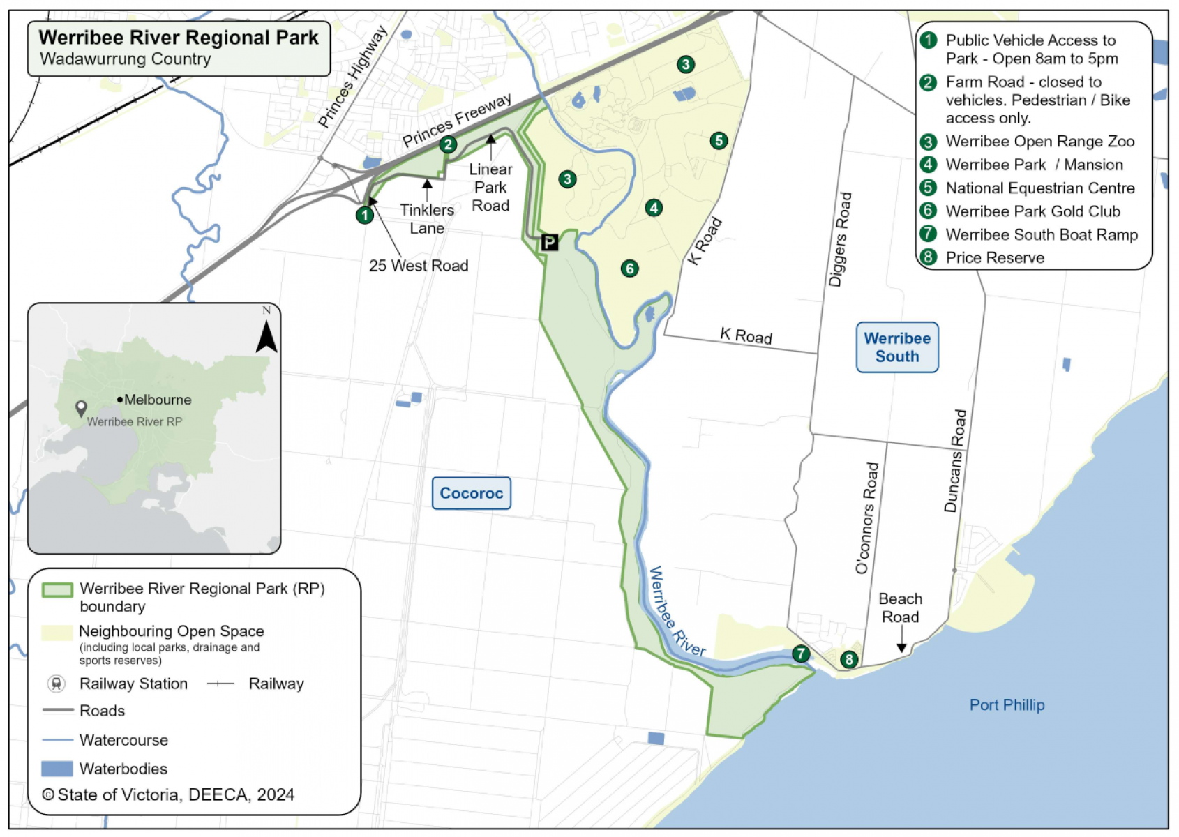
About the project

Parks Victoria is updating the Strategic Directions Plan for the 233-hectare Werribee River Regional Park, considering ways to provide more opportunities for local communities and visitors to enjoy healthy, outdoor activities.

Parks Victoria is also constructing a new trail linking the 223-hectare park with Werribee River, Werribee Open Range Zoo and nearby tourism destinations.

Where is the park located?

Werribee River Regional Park is in Werribee South, about 30 kilometres west of Melbourne’s CBD on Wadawurrung Country. The park follows the western bank of Werribee River from Princes Freeway to Port Phillip Bay.

werribee river landscape map

When can I visit the park?

Werribee River Regional Park is open for visitors to enjoy now.

The park improvements will be delivered in stages, with initial works in 2024.

  1. Government commitment to create a ring of parkland around Melbourne

    Completed November 2018

  2. Planning phase

    Completed 2019-2022

  3. Community consultation

    Completed May – July 2021

  4. Final Masterplan

    Completed June 2023

  5. Initial works

    End of 2024

Parks Victoria is managing the project and is working with key partners, Traditional Owners, stakeholders and the community to create the vision for the park.

For a fact sheet, contact the Suburban Parks Program team.

To view the updated Strategic Directions Plan, visit Engage Victoria.

Page last updated: 11/06/24